Recent Work
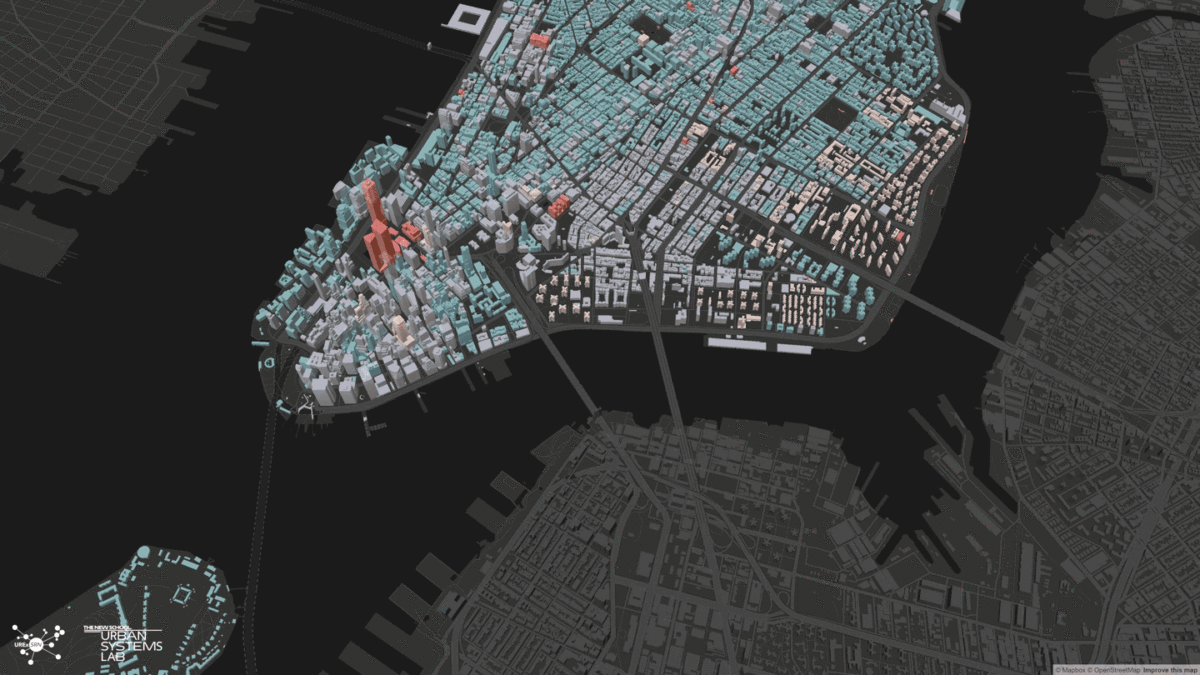
Ocellus
- Year: 2019–Ongoing
- Client and Partners: Arcadis, NYC Office of Climate and Environmental Justice
A desktop-based data visualization platform that integrates Social, Ecological, and Technological Systems (SETS) data for 11 North and Latin American cities, enhancing public planning and decision-making. More info
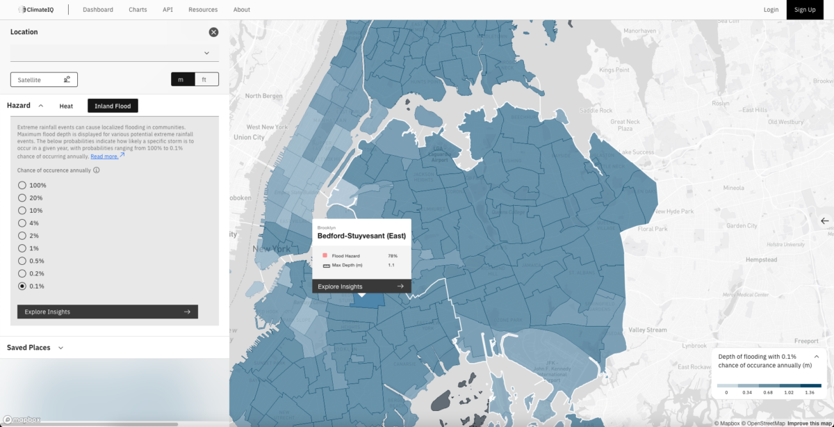
ClimateIQ
- Year: 2023–Ongoing
- Client and Partners: Google, The New School, Climasens, Beijer Institute
An AI-driven tool that helps city planners and communities assess multi-hazard climate risks and prioritize local adaptation strategies using advanced climate models and machine learning. More info
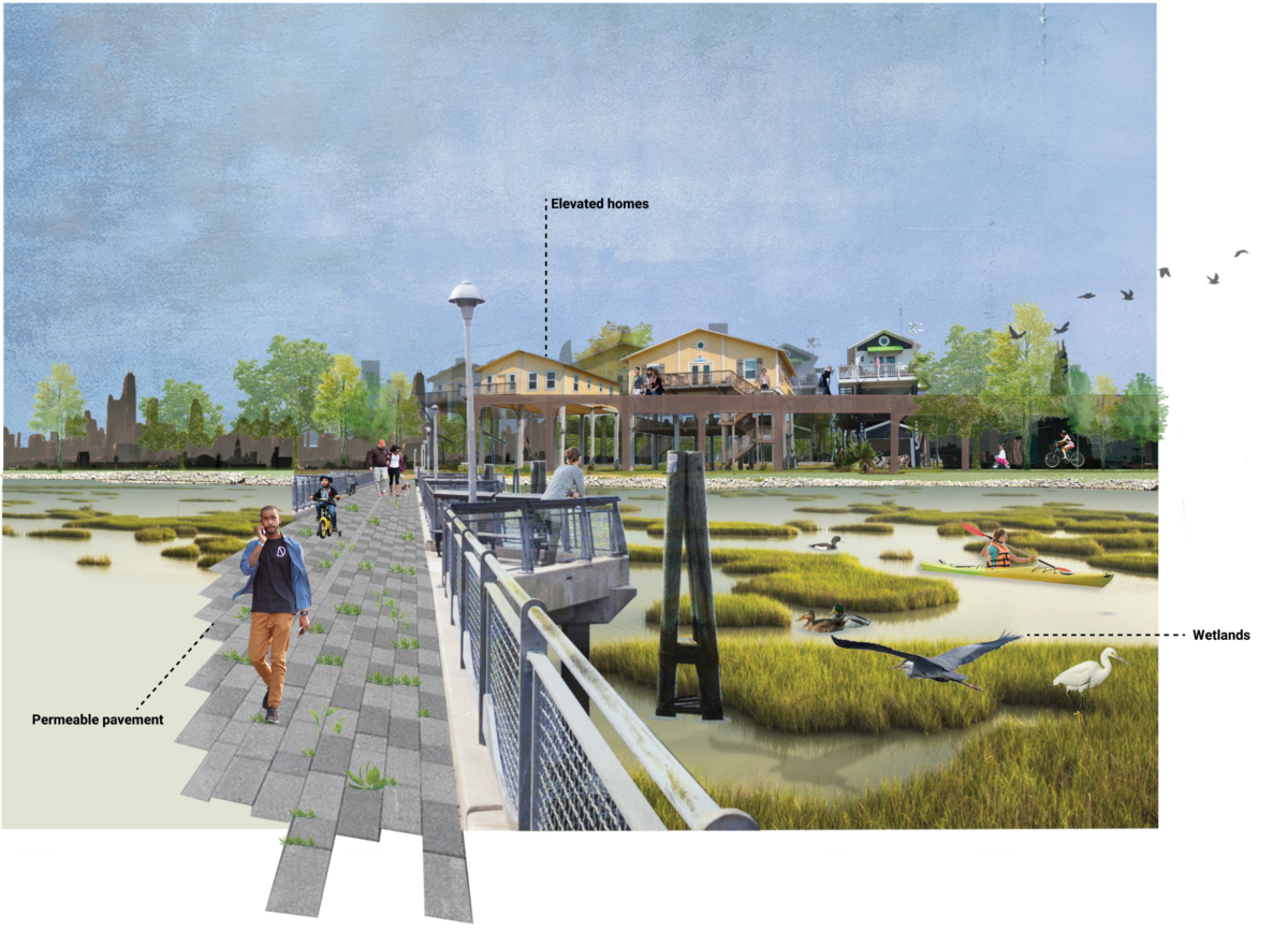
NYC Climate Adaptation Scenarios for 2100:
- Year: 2020–2021
- Client and Partners: NYC Mayor’s Office, Department of City Planning, U.S. Army Corps of Engineers, Prisa Group
A collaborative planning initiative that engaged 35 agencies and private firms to develop adaptive strategies for NYC’s resilience to climate change and extreme weather. More info
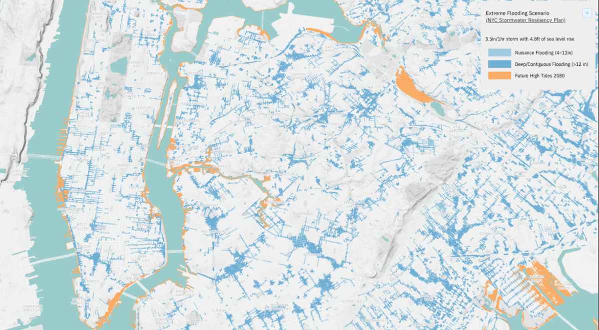
Stormwater.nyc
- Year: 2019–2021
- Client and Partners: City of New York, Department of Environmental Protection
A digital platform developed with NYC agencies to enhance stormwater system resilience through data-driven green infrastructure planning and management. More info

Ocellus XR
- Year: 2022–Ongoing
- Client and Partners: Architecture League of New York
An augmented reality application that provides interactive geospatial maps of climate risks—including heat and flooding—across New York City. More info
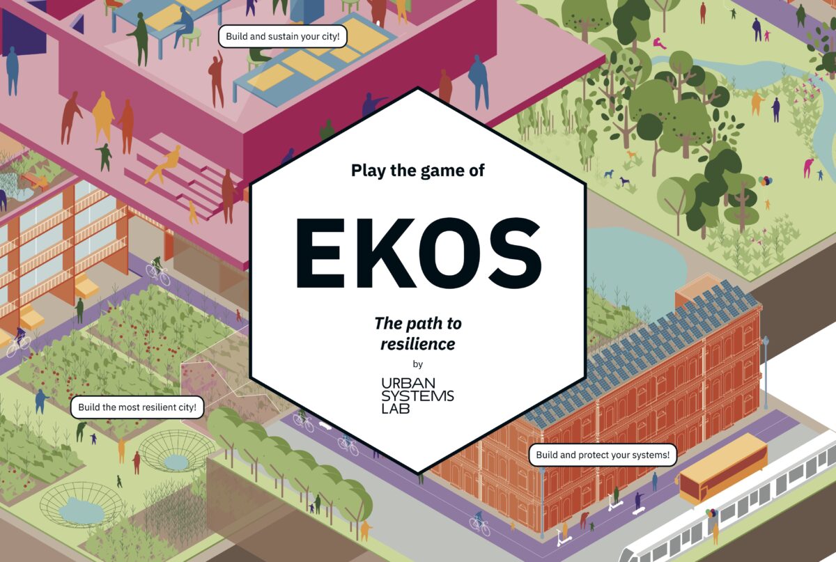
Ekos
- Year: 2022
- Client and Partners: National Science Foundation, NASA
A multiplayer board game where six community members collaborate to design a more equitable and sustainable city, used as a participatory planning tool for urban resilience. More info
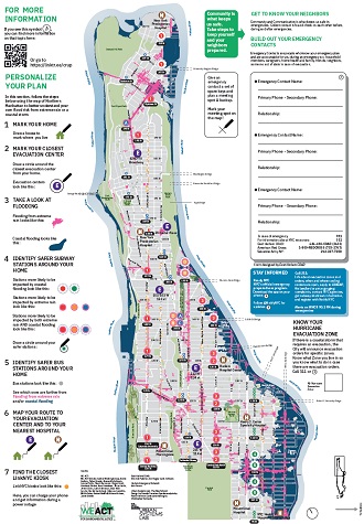
Climate Ready Uptown Plan
- Year: 2021–Ongoing
- Client and Partners: WE ACT for Environmental Justice, Groundwork USA
An interactive map developed with community groups to help Northern Manhattan residents assess their climate-related risks and plan for disasters. More info
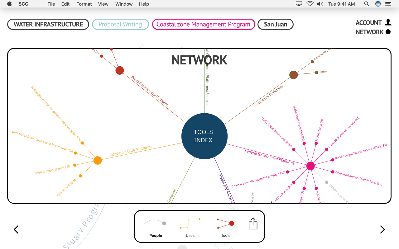
Planning Resilient Coastal Communities
- Year: 2018–2019
- Client and Partners: U.S. Army Corps of Engineers, Prisa Group, National Science Foundation
A web-based platform mapping stakeholder networks, tools, and case studies in San Juan, Baltimore, and Miami to support participatory planning and coastal resilience.
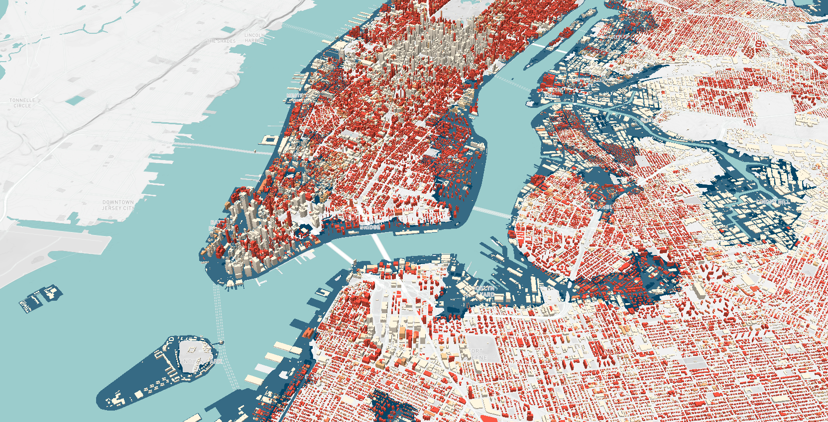
NYC Climate Vulnerability, Impact, and Adaptation (VIA)
- Year: 2022–2023
- Client and Partners: NYC Mayor’s Office, Department of City Planning, NYC Department of Environmental Protection
A comprehensive climate risk study led by The New School to assess NYC’s future climate impacts and inform policy decisions through an 18-month interdisciplinary research effort. More info
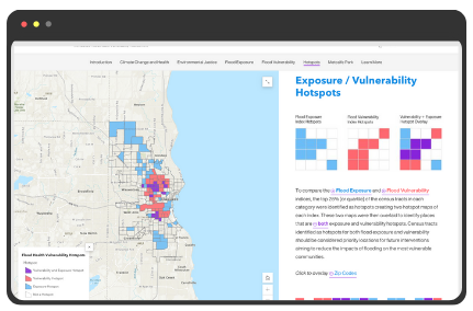
Milwaukee Flood Health Vulnerability Assessment
- Year: 2022–2023
- Client and Partners: City of Milwaukee Storm Water Management Program, Groundwork Milwaukee
A tool identifying communities most vulnerable to urban flooding due to socioeconomic and health factors, aiding equitable flood mitigation planning. More info
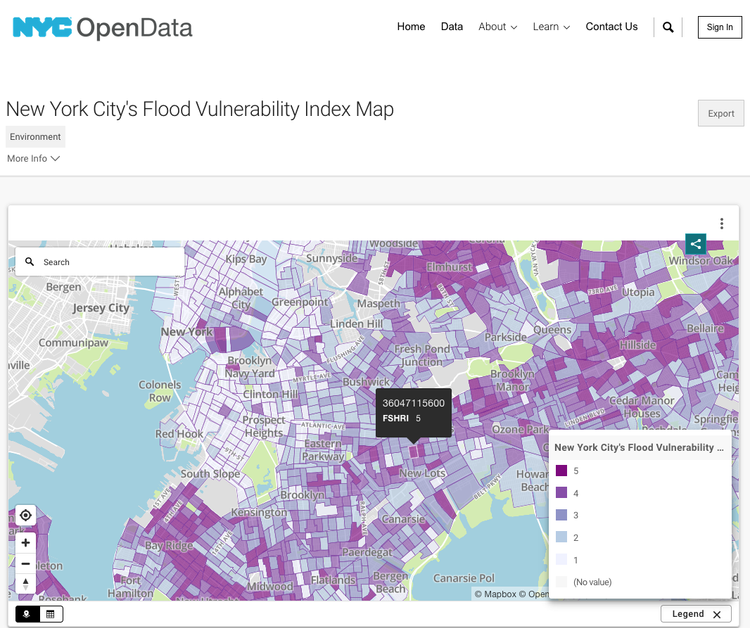
NYC Flood Vulnerability Index (FVI)
- Year: 2022–2023
- Client and Partners: NYC Mayor’s Office, Department of City Planning, NYC Department of Environmental Protection
A data-driven index evaluating NYC’s flood vulnerability across six hazard scenarios, guiding resilience policies based on exposure, susceptibility, and recovery capacity. More info
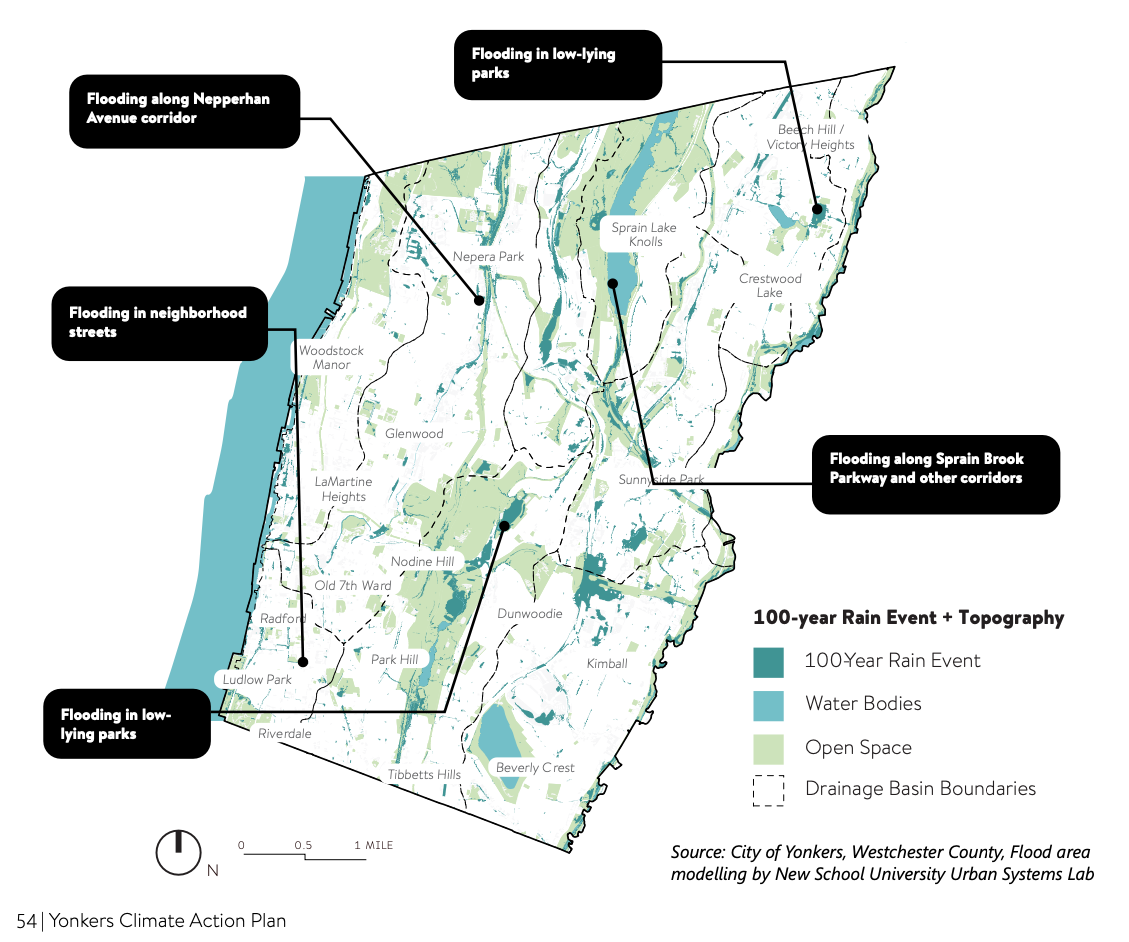
Yonkers Green Infrastructure Feasibility & Risk Analysis
- Year: 2022–2023
- Client and Partners: City of Yonkers, Westchester County, Groundwork Hudson Valley
A hydrological risk analysis using advanced modeling to assess flood risk and identify optimal green infrastructure sites, shaping the city’s Climate Action Plan. More info
Synthetic Infrastructure Solutions to Improve the Sustainability of Energy Infrastructure Systems
- Year: 2022–Ongoing
- Client and Partners: Urban Systems Lab, Arizona State University (ASU), Georgia State University (GSU), Sloan Foundation
A research initiative co-developing synthetic infrastructure models for Phoenix, New York City, and Atlanta to simulate critical failures in energy distribution systems and their cascading impacts on water, transportation, and power networks. The models aim to optimize solutions, enhance resilience, and improve the reliability of infrastructure during extreme events. More info

Green Roofs NYC
- Year: 2018–2021
- Client and Partners: NYC Bird Alliance, Green Roof Researchers Alliance
An interactive platform mapping NYC’s 60 acres of green roofs to highlight opportunities for expanding green infrastructure on the city’s 40,000 acres of underutilized rooftops. More info
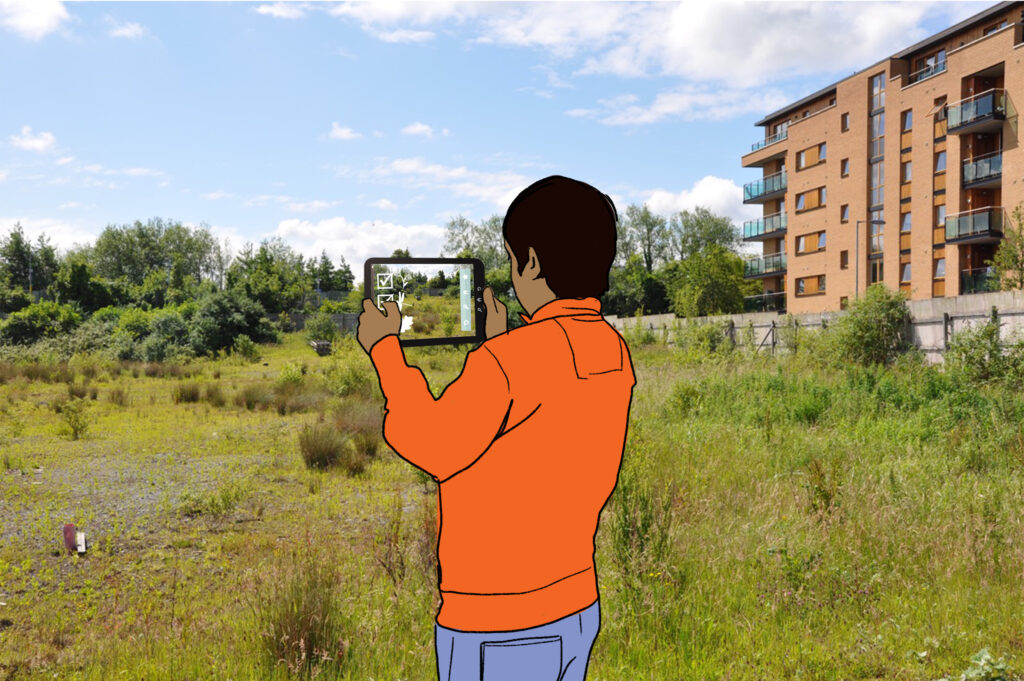
NovelEco
- Year: 2022–Ongoing
- Client and Partners: Trinity College Dublin, EU Horizon Programme
A participatory science project engaging citizens in studying urban wild spaces and novel ecosystems to better understand their ecological and social value. More info